November 23, 2009 / in Information Technology / by Jason Terry

For some reason, I have had 3 different companies ask me how to map a group of locations on a map for various reasons. One company wanted a list of their locations on a map to show on their web site. Another company wanted to display the geographical spread of their clients across the country.
There is an easy (and free) way to do this using Google Maps. If you have a Gmail account, sign in to Google Maps and then click on the “My Maps” link in the upper left hand corner under the Google Maps logo. Then click “create a new map”. For detailed instructions on setting up a custom map, read the Google Maps Custom Map Guide.
Once you have created a custom map with multiple points, you can make this map publically visible and then link to it from your web site or social media sites. Pretty cool way to show the company service locations or where you are doing business. Even better, it makes it easy for your web visitor to get maps and driving directions to those locations using a tool they are probably already familiar with… Google Maps.
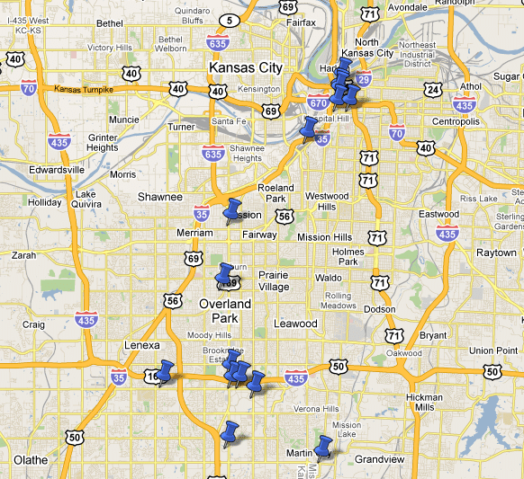
Here is a picture of a sample of Blue Gurus clients that took me 10 minutes to set up using a custom google map:

Comments are closed.
It’s actually pretty easy. I wrote an ASP.net custom control (in VB.NET) that allows you to interact directly with the Google Maps API. My control uses stored procedures from a data source (SQL, XML, XLS, etc), iterating through the records, looking at the type of record (specific custom icons), even populating the “hover” html markup, as well as a popup window with pictures, etc from the DB to generate the HTML markup in the window. I’ve even included current traffic data (available as a web service) overlayed on the map as well as google search right on the map. For instance, search “hardware store”, and google populates the nearest hardware store matches right on my custom control live map.
Really cool. Working now on interfacing my live google map with Verizon’s Field Force Manager – which logs live data from our crew’s GPS enabled phones – so that I can track my field assets as a “layer” on my open service calls map (even pulls historical data from up to 100 days ago).
I also built one playing around one day that you an punch in a Lat/Long and a radius (in miles) – and it will return a map of ALL the towers within that radius that are registered with the FCC. We use it within our company quite a bit – and I know that there’s a huge market for it with the vertical real-estate people and RF engineers, but I’ve never taken it to the next step.
If you’re interested in seeing any of the capabilities, just let me know. I’m sure it can do way more than I am asking it, but for me it works.